On the map
Where is
the Racetrack Playa?
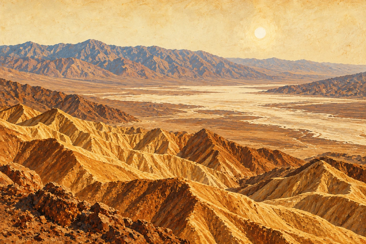
The Racetrack Playa sits in a remote valley between the Cottonwood and Last Chance Ranges in northern Death Valley. The playa is a dry lakebed about 3 miles long and 2 miles wide: beige mud at least 1,000 feet thick, left behind when an ancient lake dried up. The National Weather Service puts it at about 3,700 feet, some 28 miles east-northeast of Lone Pine as the crow flies.
The Grandstand
At the north end of the playa, the Grandstand is a big island of quartz monzonite rock sticking out of the mud, a short walk from its parking area. West of the parking lot, an old miners’ trail climbs Ubehebe Peak: 6 miles round trip and 1,800 feet of gain, rated strenuous.
The Racetrack Racetrack point forecast from the National Weather ServiceStart at the crater
How to get to
Racetrack Playa.
“Twenty-six miles of dirt.
It feels like more.”
Racetrack Road starts near Ubehebe Crater. From Furnace Creek, the drive to the Racetrack takes at least 3.5 hours each way. From Pahrump, Ubehebe Crater is about 116 miles of pavement by way of Highway 190, Furnace Creek and the North Highway, a little under three hours.
- Ubehebe Crater: the dirt starts here.
- Mile 20, Teakettle Junction: go straight for the Racetrack. Left goes to Hidden Valley and Hunter Mountain.
- Mile 22: a short spur on the right to the Ubehebe Lead Mine, worked in the late 1800s and again during World War I.
- Mile 26: the Grandstand parking area, at the north end of the playa.
- Two miles past the Grandstand: the moving rocks. Park and walk at least half a mile toward the southeast corner of the playa for the best rocks and tracks.
Drive times are from a routing service, rounded.
Ubehebe Crater
Worth the stop on the way. Ubehebe is about 2,100 years old, half a mile across and 500 to 777 feet deep, depending on which rim you measure from. The rim trail is a 1.5-mile loop with exposed edges, and hiking is not advised after 10 AM in summer. There are no restrooms at the crater; the nearest are at the unstaffed Grapevine Ranger Station, 5 miles east.
The other ways in
- Hunter Mountain Road, through Hidden Valley, usually needs 4WD. It is closed for mud: Inyo County lists it impassable as of August 11, 2026, and Death Valley lists it closed as of September 28.
- Lippincott Road climbs from Saline Valley: rough 4WD, very steep and exposed, with washouts at the cliff edge. Experienced 4WD drivers only.
- Bonnie Clare Road and Scotty’s Castle are closed for flood recovery work, with no reopening date. The North Highway is open, with loose gravel and missing shoulders from flood damage.
Washboard and sharp rock
Racetrack Road
conditions.
Racetrack Road is rough. Death Valley says good tires, 4x4 and high clearance are usually required, and standard rental cars are not recommended because they often get flat tires.
- The surface: loose gravel, deep washboard and sharp rocks. Flat tires are very common.
- The vehicle: high clearance with off-road tires. No RVs, sedans or low-clearance vehicles. It may need 4WD, since conditions change and maintenance is irregular.
- The phone: no cell coverage in the area.
- Summer: Death Valley says to use extreme caution on this road in the heat.
Death Valley’s September 28, 2026 conditions list does not show Racetrack Road closed. It does show Hunter Mountain Road closed.
The Racetrack: road warning Racetrack Road on Death Valley’s Backcountry & Wilderness Access Map (PDF) Death Valley road conditionsWhat the rocks want
Tires, spares
and clearance.
“Two spares.
One is optimism.”
- Spares: Death Valley’s rule for backcountry roads is two full-size spare tires, plus extra food and water.
- Tires: off-road tires, not highway or street tires.
- Kit: a plug kit or a can of fix-a-flat, a 12-volt air compressor, a lug wrench and every part of the jack.
- Clearance: high clearance means at least 8 inches under the lowest point of the undercarriage, on rims of 15 inches or more. High-clearance 4WD adds a low-range transfer case.
- Rentals: rental agreements often ban driving off pavement and may not cover towing. Full-size spares and tools are often missing.
- Towing: from a dirt road, it often runs over $2,000, and AAA often won’t cover it.
Twenty miles in
Teakettle
Junction.
Where Racetrack Road meets Hunter Mountain Road (also called Hidden Valley Road), in the Cottonwood Mountains, stands a road sign hung with a constantly changing crowd of teakettles. It started with one visitor, who hung a teakettle and a note to other travelers.
Straight ahead is the Racetrack. Left is Hidden Valley and Hunter Mountain, which usually needs 4WD and is closed for mud right now.
From Teakettle Junction to Homestake Dry Camp, Racetrack Road is day use only: no camping along that stretch. No camping at the Ubehebe Lead Mine either.
U.S. Geological Survey: Teakettle Junction America’s Byways: how the teakettles started Death Valley day-use roads and camping rulesThe moving rocks
Racetrack Playa
sailing stones.
“They only move when
nobody’s looking. Mostly.”
Rocks tumble onto the playa from the mountains around it, then slide across the flat floor and leave trails behind them. Some weigh as much as 700 pounds. Some have traveled as far as 1,500 feet.
How the rocks move
Researchers studied the question from the 1940s on, and nobody saw it happen. Then, in December 2013, a team led by Scripps paleobiologist Richard Norris found the playa covered by a pond no more than three inches deep.
- On cold nights, the pond froze into thin “windowpane” ice, less than a quarter inch thick.
- On sunny days, the ice broke into big floating panels.
- Light winds of about 10 mph pushed the panels, and the panels pushed the rocks through the soft mud underneath.
- The rocks moved a few inches a second, slow enough that a person watching might not notice.
The team published in PLOS ONE on August 27, 2014. One co-author figures the rocks move about one millionth of the time.
Look, don’t touch
Driving on the playa is prohibited. Do not move or take the rocks. When the playa is wet, stay off it: muddy footprints scar it for years.
The Racetrack: the moving rocks
Two wheels, one rule
Can you ride
a motorcycle there?
A street-legal one, yes. Death Valley allows dual sport motorcycles on paved and dirt roads, Racetrack Road included, as long as they are registered and street legal under California law. Every rider needs a license.
- Every road in Death Valley, paved or dirt, counts as a highway under the California Vehicle Code. Off-highway vehicles are banned from all of them: dirt bikes, motocross bikes, ATVs and side-by-sides.
- Green-sticker, off-road-registered bikes cannot be ridden in Death Valley.
- No riding off the road, and no vehicle of any kind on the playa. Off-road driving brings fines up to $5,000, or six months in jail.
- The entrance fee for motorcycles is $25 and covers up to two bikes for seven days.
More on riding this country in Death Valley motorcycle routes.
Death Valley backcountry roads: vehicle rules Death Valley: no driving off designated roads Death Valley entrance feesWhere to sleep
Camping near
the Racetrack.
Homestake Campground
A primitive campground at 3,785 feet, at the far end of the day-use-only stretch of Racetrack Road. It is extremely remote and reachable only by high-clearance vehicles with all-terrain tires. Coming from Saline Valley means Lippincott Pass, for experienced 4WD drivers only. No toilets and no water: pack in everything, pack out everything.
Mesquite Spring Campground
The developed campground for the north end, at 1,800 feet, 2 miles off Scotty’s Castle Road below Grapevine Canyon. First come, first served, with a fire grate and picnic table at each site, no hookups, and a pay station at the entrance. Open as of September 28, 2026.
Roadside camping
Allowed along dirt roads at least one mile past the junction with any paved road or day-use-only dirt road, in spots already disturbed, with your vehicle right beside the road. Groups top out at 12 people and 4 vehicles.
Recreation.gov: Homestake Campground Recreation.gov: Mesquite Spring Campground Death Valley backcountry camping rules Death Valley campground statusHigher, colder
Racetrack Playa
weather.
At about 3,700 feet, the Racetrack sits some 3,900 feet above Furnace Creek. Death Valley loses 3 to 5°F for every thousand feet you climb, so figure roughly 12 to 20 degrees cooler than the valley floor. The rocks need winter cold to move: a shallow pond that freezes overnight.
Summer is still summer out there, and the road is a long way from help. Month-by-month numbers for Furnace Creek and Pahrump are in Death Valley weather by month.
Racetrack forecast from the National Weather Service Death Valley weather and elevation Death Valley backcountry roads: rescue is slowRather ride with a chase truck?
Ride the desert
with us.
Our all-day supported ride starts just outside Pahrump, about 116 miles from Ubehebe Crater. $399 with a KTM or Husqvarna rental and fuel, or $299 on your own street-legal small dual sport. Chase truck, Chef Ruth’s homemade lunch, drinks and snacks, and a beer at the finish. Coming from the Nevada side? See Beatty, NV, Tonopah and Death Valley, and soak it off at Tecopa hot springs.
See the ride ↗